Solar Power Forecasting
Site surveying, data source for sun forecasting & cloud coverage.
Solar power forecasting involves knowledge of the Sun's path, the atmosphere's condition, scattering processes, and the characteristics of solar energy plants. Photovoltaic systems transform solar energy into electric power — and efficient production depends heavily on accurate atmospheric monitoring and grid management. Learn more about Solar Forecasting →
Visible & Infrared Sky Imaging
Accurate solar forecasting depends on a detailed understanding of the full solar spectrum. Visible-light imaging is widely used to detect cloud cover and track cloud motion vectors, providing critical input for short-term irradiance predictions — but is limited to daylight hours and can be obscured by heavy overcast.
Infrared (IR) imaging overcomes these limitations by detecting thermal differences in cloud formations day or night, enabling reliable forecasting during early morning hours, low-light conditions, and dense cloud cover. Combining both into hybrid imaging systems produces significantly more accurate and continuous solar irradiance forecasts — a key advantage for grid operators and solar plant managers.
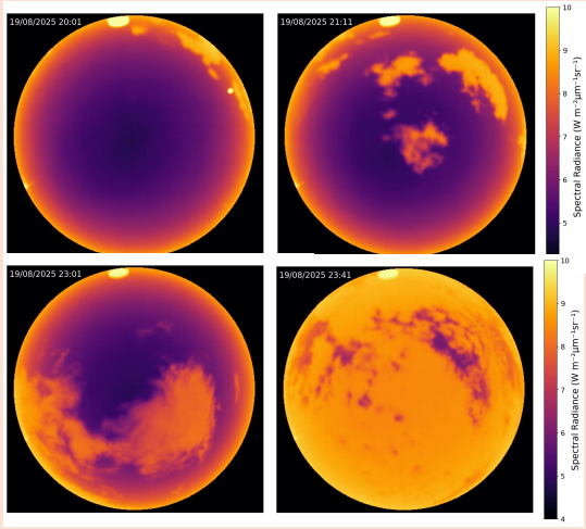
ASIVA all-sky imagery used for cloud detection and solar irradiance forecasting
☀️ Visible Light Imaging
- Cloud cover detection & motion tracking
- Short-term irradiance prediction
- High-resolution 5MP CCD imagery
- Limited to daylight conditions
🌡️ Infrared (IR) Imaging
- 24/7 day & night operation
- Thermal cloud detection in dense overcast
- 8–13 µm mid-IR atmospheric window
- Radiometrically calibrated output
Ground-Based Radiometric Sensing
Ground-based sky imagers and radiometric sensors play an equally important role in site surveying and ongoing data collection. Key instruments include:
- Pyranometers — measure broadband shortwave irradiance across the full sky dome
- Pyrgeometers — capture longwave infrared radiation for a complete radiative energy budget
- All-sky imagers — provide spatial context for cloud distribution and movement
Together these instruments support feasibility studies, panel positioning optimization, performance ratio monitoring, and nowcasting models that forecast plant output hours ahead.
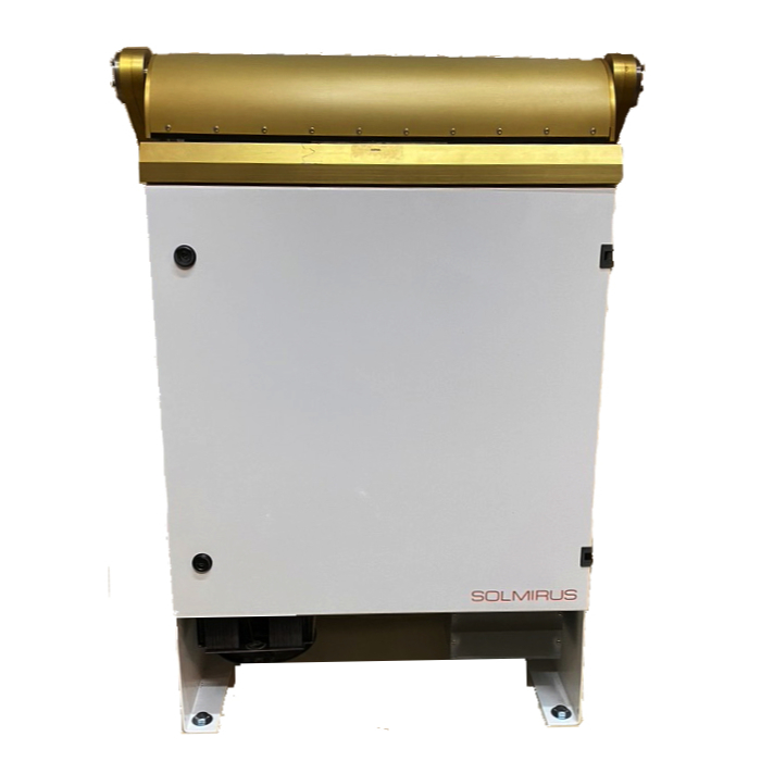
Solmirus ASIVA
The All Sky Infrared Visible Analyzer is a multi-purpose visible and infrared sky imaging system designed for ground-based cloud detection and sky analysis. Operating in the mid-infrared atmospheric window (8–13 µm) alongside a high-resolution 6MP visible CCD subsystem, the ASIVA delivers radiometrically calibrated imagery that supports solar forecasting, meteorological research, and astronomy — autonomously or as part of a larger instrument cluster.
Learn More About ASIVA →