
Optical Communications (FSO) & Directed Energy
Real-time atmospheric awareness for laser communication networks, high-energy laser systems, and ground-to-space optical links.
Integrated Environmental Intelligence for Laser Communications / FSO & High-Energy Laser Systems
Free Space Optical (FSO) communication offers unmatched bandwidth, security, and spectrum independence — but its performance is fundamentally constrained by atmospheric and sky conditions. The same atmospheric factors that challenge FSO communications directly impact the propagation, pointing, and performance of high-energy laser (HEL) and directed energy systems.
Strategic Partnership
Through a strategic partnership with Miratlas, we deliver the only fully integrated solution on the market that comprehensively addresses atmospheric and environmental conditions impacting ground-to-space and ground-to-ground laser systems — across both FSO communications and high-energy laser applications.
What Our System Provides
Our platform combines multi-sensor data acquisition, atmospheric characterization, and real-time analytics to support laser systems operating in challenging environments.
☁️ Sky & Cloud Monitoring
Detection and characterization of clouds, aerosols, and obscurants impacting optical paths.
🌀 Turbulence Assessment
Measurement and modeling of turbulence parameters (r₀, isoplanatic angle), transmission loss, and variability affecting beam propagation and wavefront quality.
⚡ Real-Time Operational Support
Environmental intelligence to inform link scheduling, pointing decisions, and adaptive system behavior.
🔗 Integrated Architecture
Designed to interface directly with laser terminals, networks, ground stations, and beam control systems.
Laser Communications & FSO
Our solutions are purpose-built for organizations deploying or operating:
- Ground-to-space optical communication links (LEO, GEO, deep space)
- Ground-to-ground laser communication networks
- Hybrid RF/optical systems requiring intelligent link management
- Mission-critical or high-availability optical communication infrastructure
By transforming environmental uncertainty into actionable insight, we enable FSO systems to operate with greater resilience — even under variable sky and weather conditions.
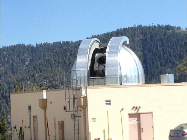
All-sky IR monitoring supporting ground-to-space optical link operations
High-Energy Laser & Directed Energy Systems
Atmospheric conditions are among the most significant performance drivers for HEL and directed energy systems. Turbulence-induced wavefront distortion, thermal blooming, aerosol scattering, and variable transmission all directly affect beam quality and effective range. Our all-sky infrared imaging and atmospheric characterization platform provides the real-time environmental intelligence HEL programs require:
Turbulence Profiling
Continuous characterization of atmospheric turbulence strength and structure for adaptive optics (AO) sizing, performance prediction, and operational planning.
Transmission Monitoring
Real-time detection of conditions affecting beam propagation and transmission loss along the optical path.
Site Characterization
Long-duration sky and atmospheric data records to support site evaluation, diversity analysis, and system siting decisions.
Operational Awareness
Continuous sky monitoring to support mission planning, scheduling, and go/no-go decision support.
FSO Solutions White Paper
In-depth overview of atmospheric challenges for FSO systems and how our integrated instrumentation addresses them.
Inquiry Form
Tell us about your FSO or atmospheric sensing project. Please complete the form below and a member of our team will respond within 1–2 business days.
Inquiry Submitted
Thank you — your project inquiry has been received. A member of the Solmirus team will be in touch shortly.